Old Mining Wagon Wheel Tracks in Superior Arizona
Sometimes you come across the most unexpected things when you are out exploring. The other day, I was scouring the internet for a close-by spot to go check out with the family and dogs. Living in Queen Creek, AZ, we have access to thousands of acres of wilderness, mountains, and deserts to explore, and I found a spot that piqued my attention. There are Old Mining Wagon Wheel Tracks in Superior Arizona from the 1870’s nearby!!
Superior, Arizona and It’s Amazing History
“Kids! Dogs! Load up! We’re going on a mini-adventure!”
We packed some water and snacks and loaded up in the Jeep. Heading North from Queen Creek, the East on Highway 60, we cruised out towards Superior, Arizona. The Desert Southwest was made for exploring, with miles of dirt roads and with a rich, wild history, Superior is no exception.
Superior is a small town of around 3000 people nestled in the hills of the Superstition Wilderness. Originally called Queen, AZ, the town was founded when the first mining claims were staked around 1875. Queen had a population of approximately 100 people in 1880 when the Silver Queen Mining Company was formed. Unsuccessful attempts to men the rich copper deposits failed and the mining company was purchased by Boyce Thompson in 1910, who resurrected it and created the Magma Copper Company which produced Copper, Silver, gold, and zinc for 86 years.
Mining Near Superior Arizona
The town was carved out of desire and promise of mining success. It was hard work in uncertain times. In the midst of the American Indian Wars, a company of Apache were ambushed by the US cavalry, who killed 50, and forced the remaining 75 up a mountain to jump to their death, from a cliff later name Apache Leap.
The town of Superior was established in 1902 and named after the Lake Superior & Arizona Copper Company.
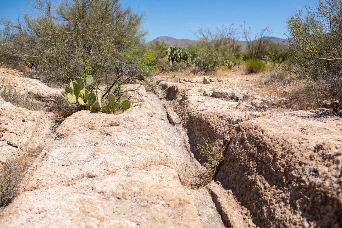
The history of hard work and rough times is evident in the Wagon Wheel Tracks just west of the town, between the Boyce Thompson Arboretum and Superior Airport, just off Highway 60. Despite being only a couple of hundred yards from the highway, to get to the tracks, from the west, you drive past the airport and turn on to Apache Tear road, then work your way on dirt roads over to Perlite road.
Apache Tears Road to FSR 3154
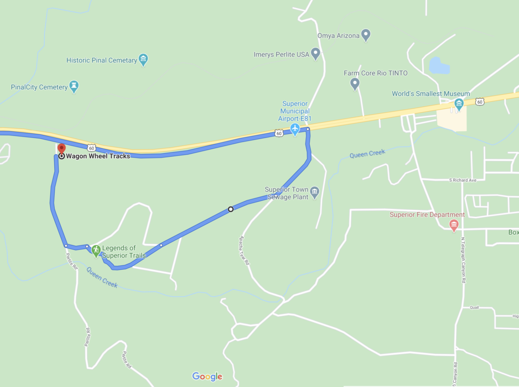
The road leading up to the tracks has many sidetracks, and much of it is not maintained. This area can suffer erosion from runoff and borders Queen Creek (the actual creek, to the town) which can flood in the spring. We found ourselves on a couple of the side chutes and definitely needed four-wheel drive. The trails are clearly marked, and eventually, we found ourselves at the Wagon Wheel Tracks.
History of the Old Wagon Wheen Tracks
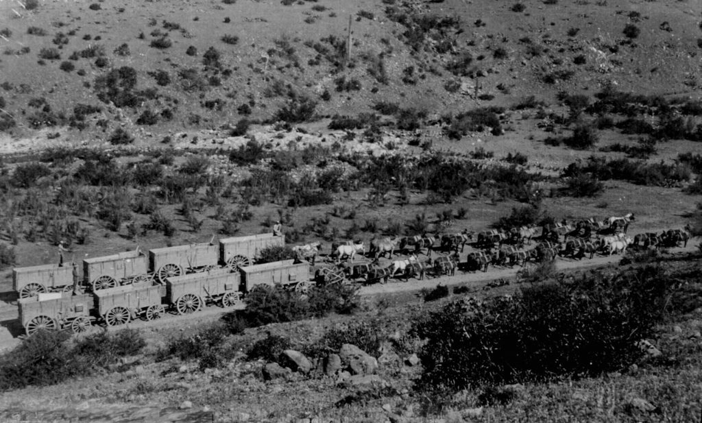
Time for a little more history! The Wagon Wheel Tracks are a historical landmark. They were formed in the 1870s and 1880s from ore-laden wagons bringing their heavy loads from the Silver King Mine to the Pinal Mill on Queen Creek. A large section of the road was on welded volcanic tuff, which is a cement-like surface of rock composes of compacted volcanic ash. This of how many heavy trips back and forth it would have taken to carve this track into the rock!
When we arrived at the tracks, we got put and walked the length of them. They appear out of nowhere and disappear just as fast. From one end of sand and dirt to a large swath of rock, and back to sand and dirt at the other end several yards into the desert. After 150+ years, you would never expect to see evidence of these wagons, but by a stroke of geological luck, the tracks are here for future generations to enjoy!
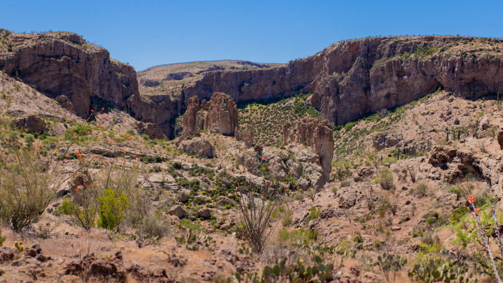
After spending some time checking out the tracks, we jumped back in the Jeep and headed back out. We saw a side road heading down toward Queen Creek, so we followed it and found a shadow crossing and dirt road leading up the mountain. We drove up this unmaintained track (requires high clearance vehicle) all the way to its end and enjoy spectacular regional views of the beautiful, yet unforgiving Superstition Wilderness. As we drove up, we notice the foundation and concrete wall of a long-forgotten structure, so we decided to try to find it on the way down.
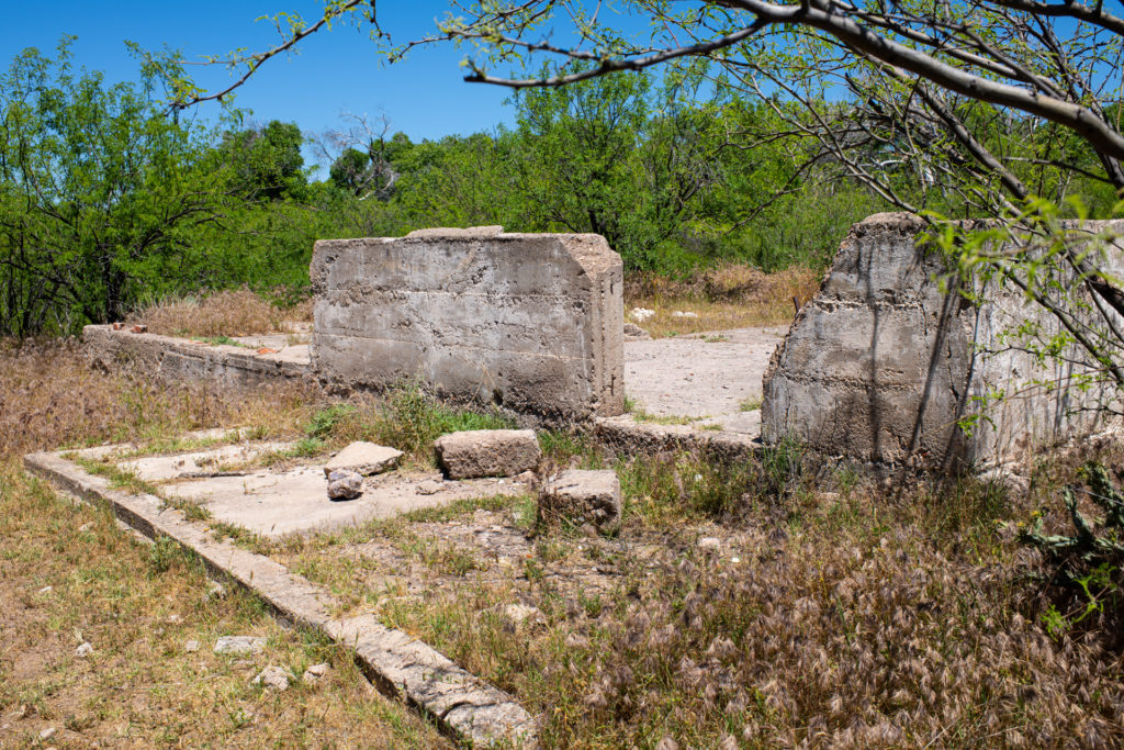
We crossed back over Queen Creek and headed back to the west. We found another road and crossed the creek again, and headed into a lower valley. We found the concrete foundation and walls, as well as an old well. I don’t have any information on the foundation or well, but feel free to comment if you know what it was. Perhaps a mining cabin? Cattle ranch house?
Heading home after an awesome day. Ready to go again!!
We made our way back through the Dirt road to the highway and headed home. What started as a short adventure to some really amazing Wagon Tracks for the 1870s ended up being a longe exploratory trip in the Superstition Wilderness. We are definitely mapping and planning future trips, as this area may be hot, dusty, and unforgiving, but has a rich, beautiful history. This little rock we call Earth has so much to share. Go play outside. Get out and explore.
- OPENROAD Winches: Highest quality, priced for everyone.
- Rugged Ridge Eclipse Mesh Sun Shade Install
- Exploring Shoofly Village Ruins & Wagon Wheel- Payson, Arizona
- $12-$20 DIY Jeep Tailgate Table Build
- Nextbase Dash Cam Comparison & Review


You May Also Like
Black Canyon Lake – Heber Arizona
Tonto National Monument